The reimagined franchise mapping software that combines territory mapping, analytics, and CRM—all in one powerful platform built for franchise growth.
Franchise territory mapping is the foundation of successful franchise development. Our platform revolutionizes how franchisors create, analyze, and sell territories with precision mapping tools, AI-powered demographic analysis, and integrated CRM. Whether you're mapping territories by zip code, census tract, or radius, Zors delivers the business intelligence you need to make data-driven territory decisions. From initial territory design to ongoing management, our franchise territory mapping software streamlines your entire process.

Everything you need to map, analyze, sell, and manage franchise territories with business intelligence and contact management in one integrated platform.
Franchise territory mapping made simple. Create precise territory boundaries using multiple methods—select zip codes, draw census tracts, define radius areas, or free-draw custom shapes on an interactive map. Our intuitive territory mapping software lets you visualize franchise boundaries instantly, adjust territories with drag-and-drop ease, and export professional territory maps for FDD disclosures. Perfect for franchise development teams managing single territories or entire national networks.
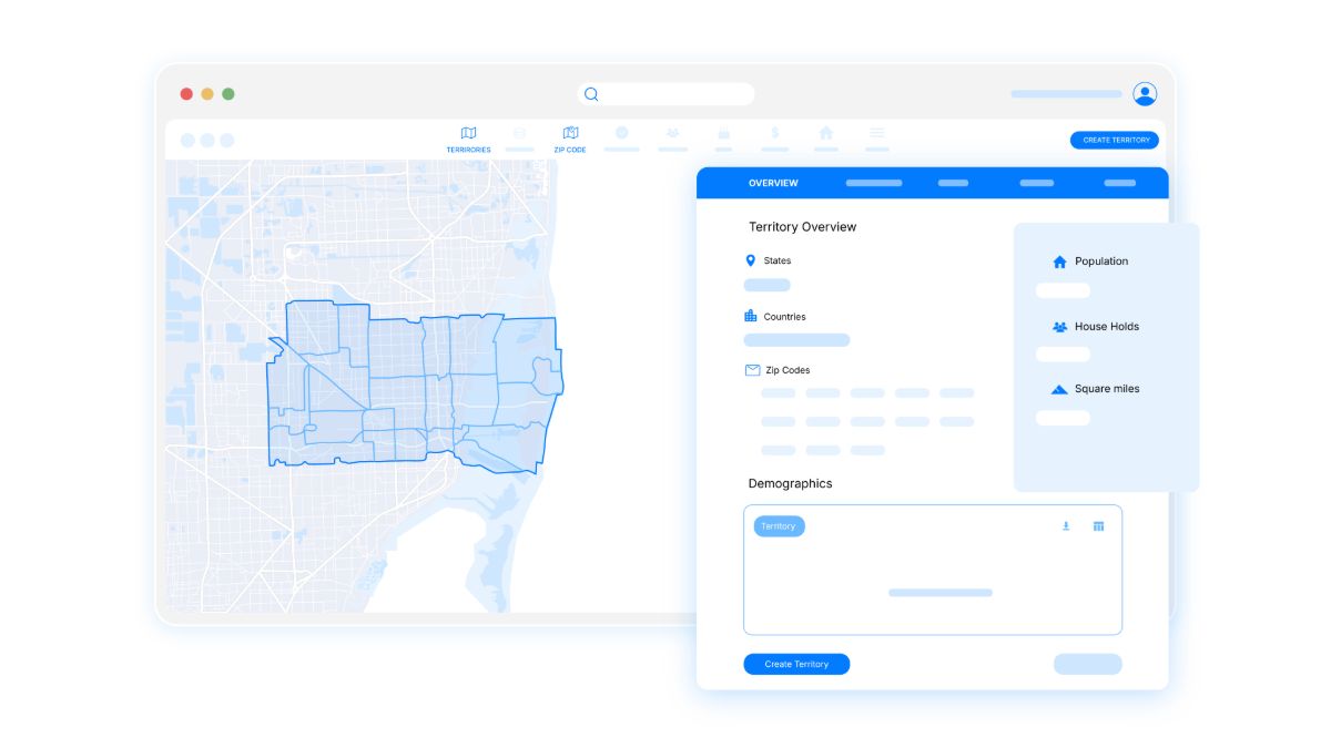
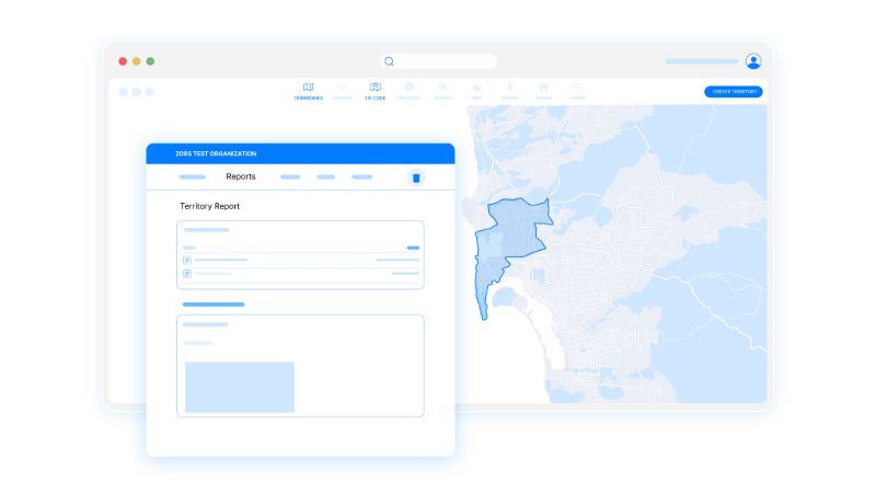
Make data-driven territory mapping decisions with comprehensive demographic and economic analysis. Generate detailed territory reports with interactive charts and data tables powered by US Census Bureau and American Community Survey data. Analyze population density, household income, age distribution, education levels, and housing statistics for every mapped territory. Perfect for validating territory boundaries and supporting FDD disclosures with credible demographic evidence.
Explore DemographicsConnect your franchise territory mapping with comprehensive CRM. Manage franchisees, leads, vendors, and territory assignments all in one integrated platform. Assign contacts to specific territories, track territory ownership changes, and maintain a complete history of territory transfers. Import contacts via CSV, geocode addresses automatically, and visualize your entire franchise network on the map. Link documents, track milestones, and manage relationships throughout the franchise lifecycle.
Discover CRM Features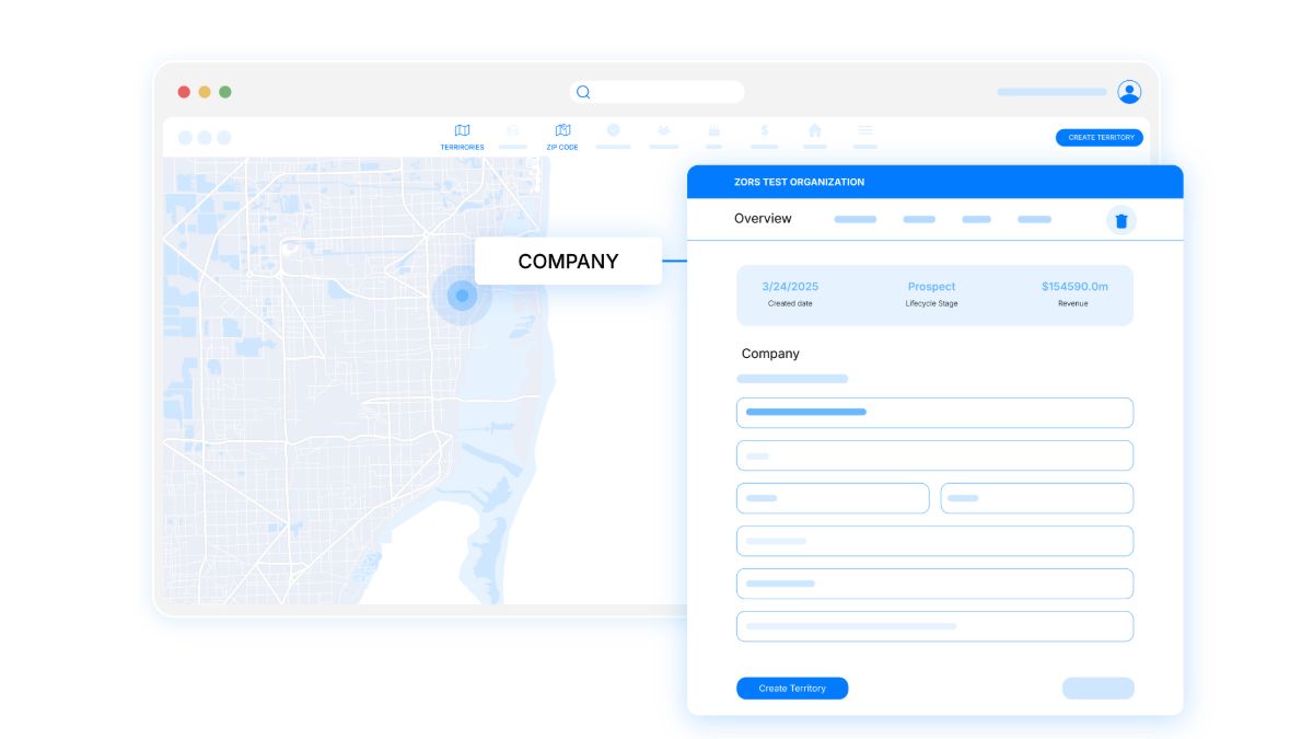
Enhance your franchise territory mapping with powerful business intelligence. Discover competitors, suppliers, and customers within every mapped territory using our comprehensive POI (points of interest) database. Search by industry category, analyze market saturation, and identify untapped opportunities. View business locations overlaid on your territory maps to assess market density, competitive positioning, and franchise site selection. Essential for territory validation and market analysis.
View Business IntelligenceVisualize your entire franchise network on the map with contact overlays. Track leads, franchisees, and prospects geographically, identify territory gaps, and optimize your sales strategy with location-aware CRM tools and territory coverage analysis.
Learn Contact Mapping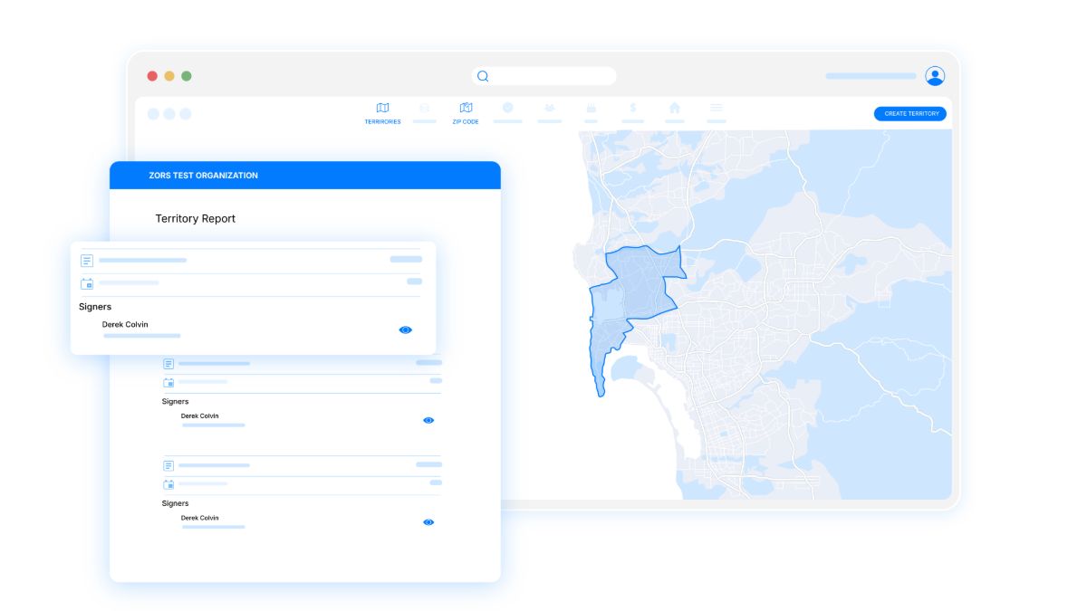
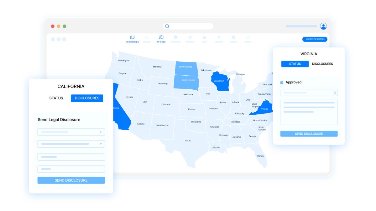
Track and manage state registration status for all your territories with visual dashboards and automated reminders.
Manage State RegistrationMonitor franchise development progress from initial inquiry to grand opening. Track milestones like FDD delivery, discovery day, lease signing, training completion, and opening dates with automated reminders and visual progress dashboards.
Track Franchise MilestonesOverlay population, housing, age data, and National Risk Index across the entire US to identify optimal territories and potential risks.
Franchise territory mapping is the process of defining geographic boundaries for franchise territories using tools like zip codes, census tracts, or radius-based areas. Effective territory mapping helps franchisors allocate territories fairly, analyze market potential, and comply with FDD disclosure requirements.
With Zors, you can map franchise territories by zip code by simply selecting zip codes on an interactive map or importing a list. Our software automatically generates territory boundaries, calculates population demographics, and produces professional territory maps suitable for FDD Item 12 disclosures.
The best method depends on your franchise model. Service-based franchises often use zip codes or radius territories, while retail franchises may prefer census tracts for demographic precision. Zors supports all methods—zip code selection, census tract mapping, radius drawing, and custom free-draw boundaries—so you can choose what works best for your brand.
Demographic analysis helps validate territory boundaries by providing population, income, age, education, and housing data for each territory. This data supports territory pricing, helps prospects evaluate opportunities, and provides credible evidence for FDD disclosures. Zors integrates US Census and ACS data directly into every mapped territory.
Join Zors to map, sell, and manage your territories with confidence.